


Work with data
Tools aimed at helping practitioners and communities turn data from low-cost sensors and wearables into FAIR and CARE information – easy to access, combine and trust, and ready to support evidence-based policy.
Data tools
31 toolsTools developed within CitiObs to turn data collected by citizens into reliable, usable information. They help you organise and share data using open standards, check and correct its quality, and explore it on maps and charts, from single sensor readings to air quality maps of Europe.
 Data tool
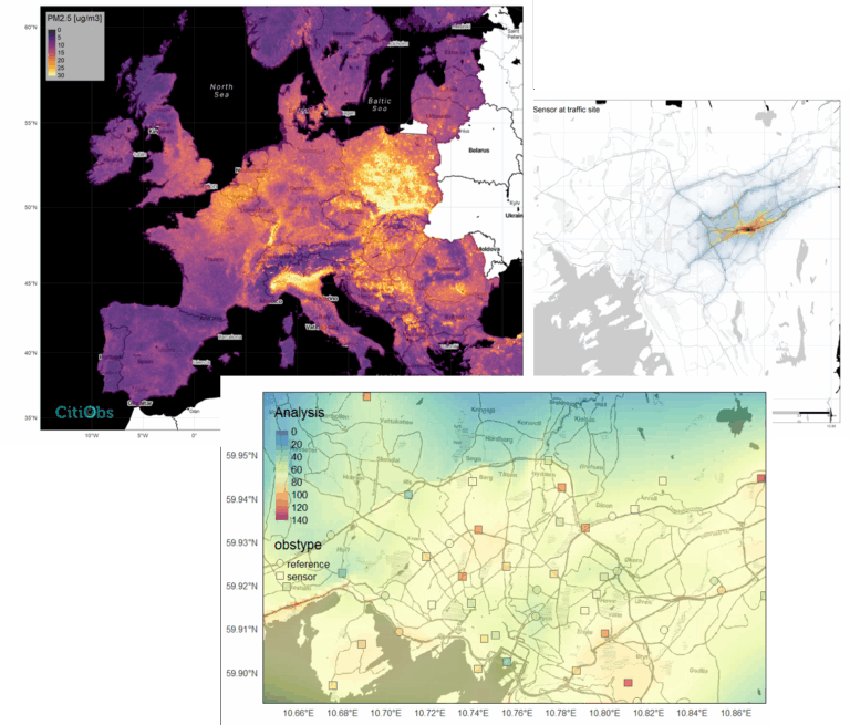
Air Quality Mapping at European Scale
The sMESH model (Satellite and ML-based Estimation of Surface air quality at High resolution) is a machine-learning framework that downscales regional air quality forecasts to estimate daily (and in some implementations hourly) surface PM₂.₅ concentrations over Europe at ~1 km resolution, producing high-resolution maps that support analysis and policy applications.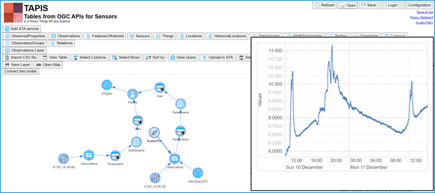 Data tool
Browser-based visualization tool
TAPIS is a simple, browser-based tool developed within the CitiObs project to help communities and Citizen Observatories easily visualize their data.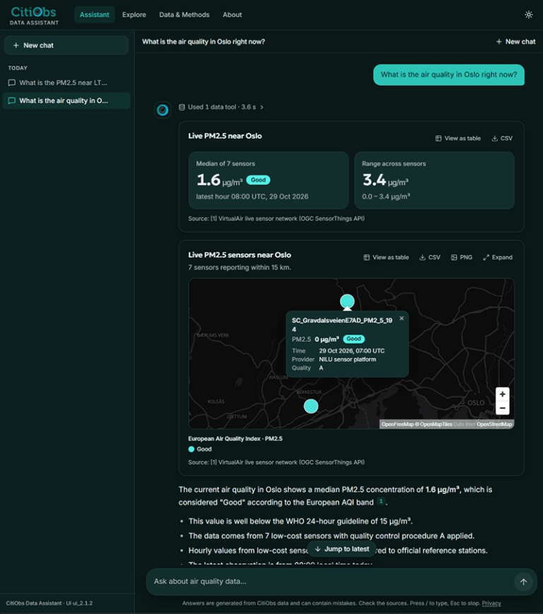 Data tool
CitiObs Data Assistant
An AI-powered assistant that helps citizens, researchers and city authorities explore and understand citizen-science environmental data.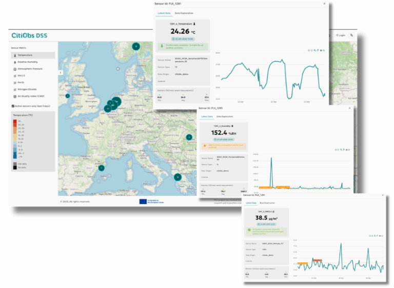 Data tool
CitiObs Decision Support System (DSS)
CitiObs has developed a web-based dashboard to display validated and interoperable data.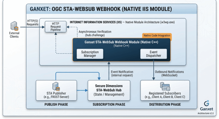 Asynchronous messaging
Gaxnet (little hook) on IIS
A C++ implementation of a WebHook subscriber compatible with Windows IIS Native Code. This tool implements a server that dialogues WebSocket from a web page and client that dialogue with a WebHub that implementing a W3C WebSub.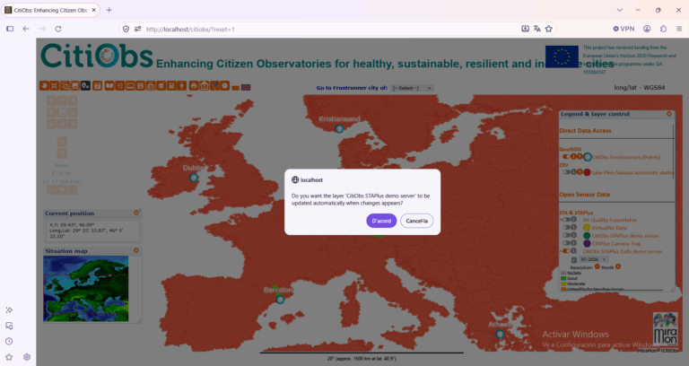 Asynchronous messaging
MiraMon
The MiraMon Web Application displays the historical sensor reading and updates the chart based on new data received via STA-WebSub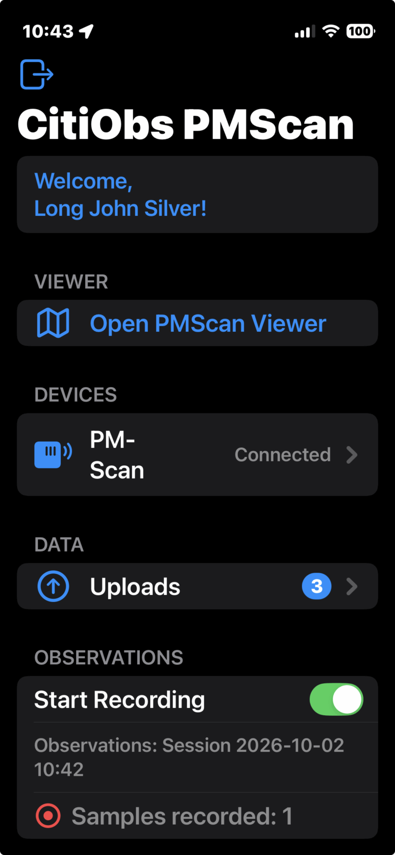 Citizen Science with STAplus
PMScan mobile app
CitiObs PMScan mobile app captures air quality with the wearable sensor PMScan and uploads the data to a STAplus service.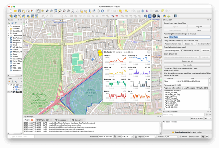 Citizen Science with STAplus
QGIS SCK plugin
The QGIS SCK plugin allows to record air quality with the sensor from the Smart Citizen Kit from IIAC using the QGIS desktop application Data tool
Quality Control and Data Validation Tool
FILTER (Framework for Improving Low-cost Technology Effectiveness and Reliability) is a quality control and correction system for PM2.5 static low-cost sensor networks, PM2.5 mobile/wearable measurements and noise measurements.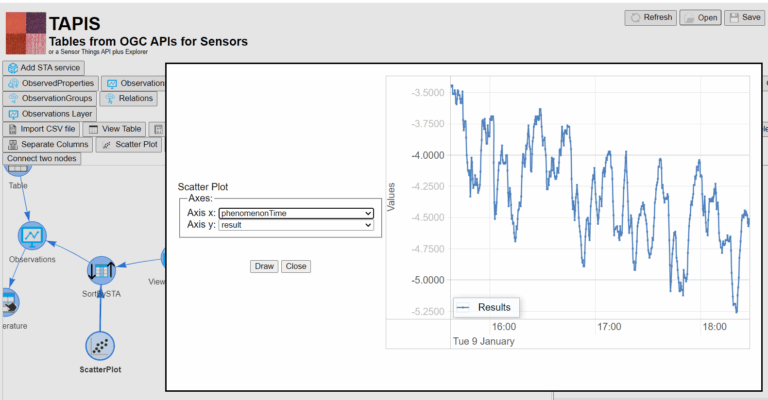 Asynchronous messaging
See the last value in TAPIS
The 'last value receipes' illustrates how to monitor a variable capture by a particular party. The way this is done, is conditioned by the STAplus entities data model (see the figure below) that relates Observations to Party through Datastream. STAplus standard
STA DGGS
OGC 26-057 adds a Cell entity so observations can be grouped into Discrete Global Grid System zones and aggregated.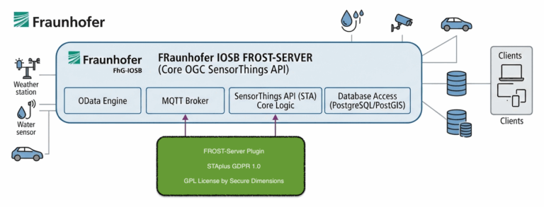 Citizen Science with STAplus
STA DGGS plugin implementation
The STA-DGGS plugin implements the STA-DGGS Standard. The plugin can be deployed with the Fraunhofer FROST-Server framework which is the open source reference implementation for the OGC SensorThings API.