
TAPIS
About the tool
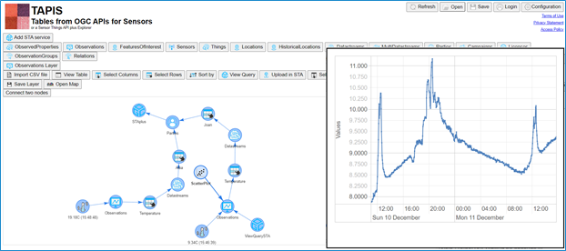
TAPIS is a simple, browser-based tool developed within the CitiObs project to help communities and Citizen Observatories easily view, manage, and analyze environmental data collected through sensors and online platforms. Designed for users with little or no technical background, TAPIS transforms complex data queries into a visual, interactive experience, making it easier to explore and act on citizen-generated data.
Built to work with the SensorThings API, STAplus, and a variety of open data formats (including CSV, JSON, and GeoJSON), TAPIS lets users connect to online data sources, filter and group data in tables, and visualize information as maps, bar charts, pie charts, or scatter plots, all within the browser, with no installation required. It also supports CSV data upload and integrates with the MiraMon Map Browser for creating dynamic, web-based maps.
Inspired by the user-friendly interface of Orange Data Mining, TAPIS makes complex data analysis accessible and meaningful, helping citizen communities better understand their observations and share insights with decision-makers.
Explore the tool:
GitHub (Code & Resources): https://github.com/CitiObs/Tapis
TAPIS Help page: https://www.tapis.grumets.cat/help/


