
SMESH (MAPAIR)
About the tool
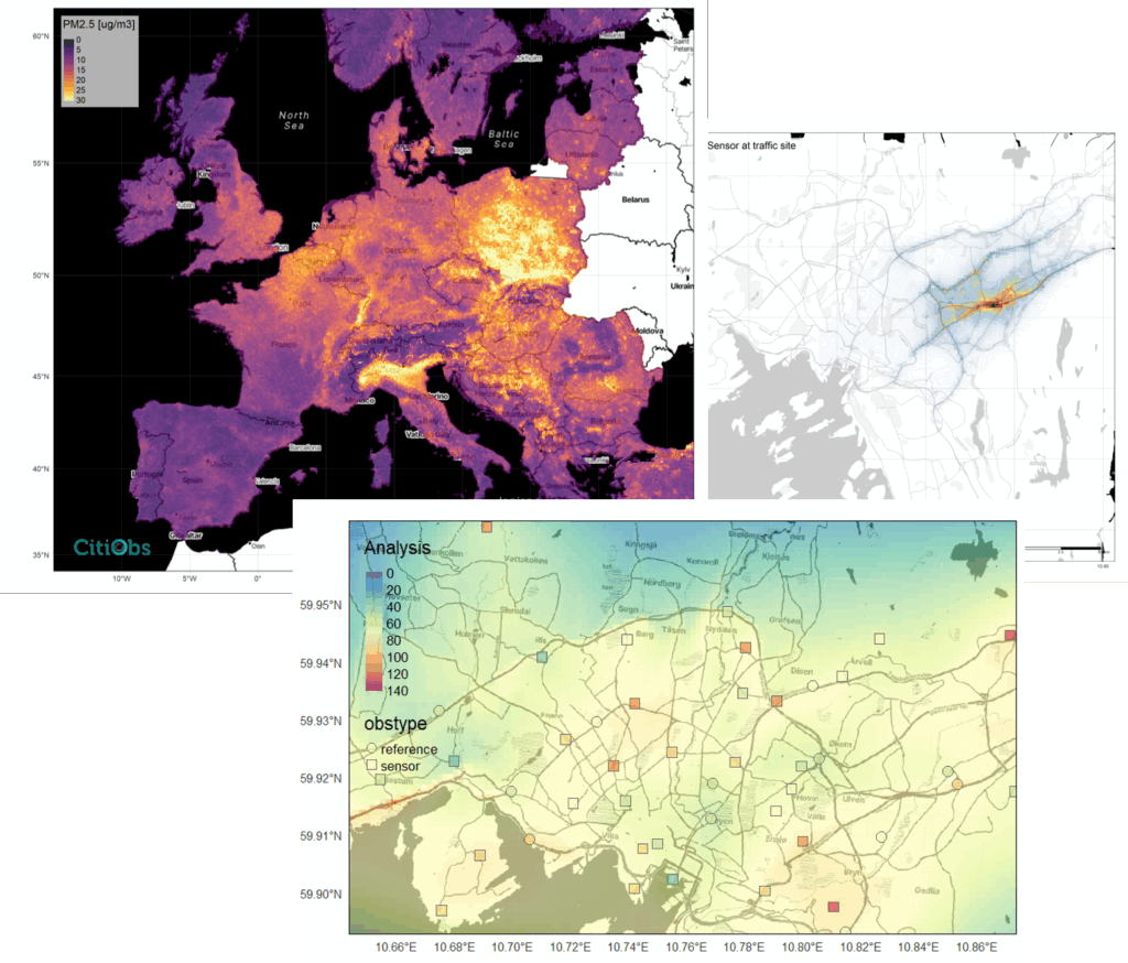
The S-MESH (MapAir) Tool provides a set of methods for transforming scattered air quality measurements from Citizen Observatories into spatially continuous maps that can be used for analysis and decision-making. Developed within the CitiObs project, MapAir focuses primarily on PM2.5, the most commonly measured pollutant by low-cost sensors, and supports both European-scale mapping and high-resolution local mapping.
At the European level, MapAir uses a machine learning model called S-MESH (Satellite and ML-based Estimation of Surface air quality at High resolution) to generate hourly 1 km resolution PM2.5 maps. The model combines satellite data, existing air quality models, and quality-controlled measurements from networks like sensor.community and PurpleAir.
For cities and small areas, MapAir applies an Optimal Interpolation (OI) technique – similar to geostatistics but more flexible – built on methods from numerical weather prediction. This approach produces detailed and accurate local maps by integrating citizen-collected data with high-resolution background models, while accounting for observation uncertainty and spatial variation.
By bridging the gap between point-based sensor data and large-scale insights, MapAir supports:
- Improved usability of citizen-collected data for policy and planning
- Error detection through model comparison
- Generation of decision-ready environmental information
Though focused on air quality, especially PM2.5, the MapAir methods can be adapted for other environmental variables in the future.
Explore the tool:
GitHub (Code & Resources): https://github.com/CitiObs/MapAir


